Species Details
- Species name
- Zora armillata Simon, 1878
- Synonym
- Zora letifera Falconer, 1912
- Taxonomy
- Animalia :: Araneae :: Zoridae
- acid & sedge peats
Distribution
The species has been recorded from Wicken Fen, Cambridgeshire; Woodwalton Fen, Huntingdonshire (where the record is doubtful and requires confirmation); and Hartland Moor, Slepe Heath and Morden Bog, Dorset. It is also known from Spain, France, Greece and Sweden.Habitat and ecology
Known from two rather dissimilar habitats in Britain: among litter and cut reeds in fens in East Anglia, and in wet heath and bog in Dorset, possibly more in wet heath rather than truly in bog. Adults of both sexes have been found between April and September, a female in October.Status
There are no records since 1980. The spider is thought to have be fairly frequent in the past on Hartland Moor and Morden Bog. The last record at Wicken Fen was in 1977. The 1997 record for Wicken Fen mentioned in Harvey et al. (2002) is now considered incorrect, the record mapped in that publication for Chippenham Fen has not been substantiated and there is doubt over the record for Woodwalton Fen.Threats
Despite the major fire at Hartland Moor in 1976, the site revegetated well, but lowering of the water table, such as by drainage of adjacent land and/or water abstraction, would damage all the listed localities of this species. A lower water table often leads to scrub invasion, which increases the drying process and shades out the fen and bog plant communities. The effects of drainage on the fenland sites are well known (e.g. Godwin 1978; Darby 1983). The catchment of Morden Bog has also been greatly modified by the extensive conifer forestry in the area this century.Management and conservation
Where drainage leads to scrub invasion, it is only through much manual and mechanical scrub clearance that former sedge and litter beds can be restored and the fenland vegetation maintained, and even this probably differs markedly from what would be present if drainage of the surrounding area had not been carried out. Grazing, mowing and sedge harvesting are part of the management of Wicken Fen with the aim of maintaining scrub-free areas. Text based on Dawson, I.K., Harvey, P.R., Merrett, P. & Russell-Smith, A.R. (in prep.).Stats
- First recorded
- 1900
- Last recorded
- 2025
- Total records
- 39
- Total visits
- 37
Conservation status
Zora armillata
| Source | Reporting category | Designation | Date designated | Comments |
|---|---|---|---|---|
| A Review of the scarce and threatened spiders (Araneae) of Great Britain: Species Status No. 22 (Sep 2017) | Rare and scarce species | Nationally Rare. Includes Red Listed taxa | 42979 | |
| A Review of the scarce and threatened spiders (Araneae) of Great Britain: Species Status No. 22 (Sep 2017) | Red listing based on 2001 IUCN guidelines | Critically Endangered | 42979 | B2ab(ii,iv) is justified because there are no records of this species since 1980. While there have been surveys CR(PE) is not yet considered justifiable. The spider is thought to have been fairly frequent in the past on wet areas of Hartland Moor and Morden Bog, Dorset. The catchment of Morden Bog was greatly modified by afforestion with conifers in the area last century. Historical records from the Cambridgeshire Fens are now in doubt. The last record at Wicken Fen, in 1977, is now considered incorrect and there is doubt over the Woodwalton Fen record. The record mapped in the Provisional Atlas for Chippenham Fen has not been substantiated. The lowering water tables, for example by drainage of adjacent land and/or water abstraction, would damage all the listed localities for this species. Threats: Lowering of the water table, such as by drainage of adjacent land and/or water abstraction, would damage all the listed localities of this species. A lower water table often leads to scrub invasion, which increases the drying process and shades out the fen and bog plant communities. The effects of drainage on the fenland sites are well known (e.g. Godwin 1978; Darby 1983). The catchment of Morden Bog has also been greatly modified by the extensive conifer forestry in the area this century. |
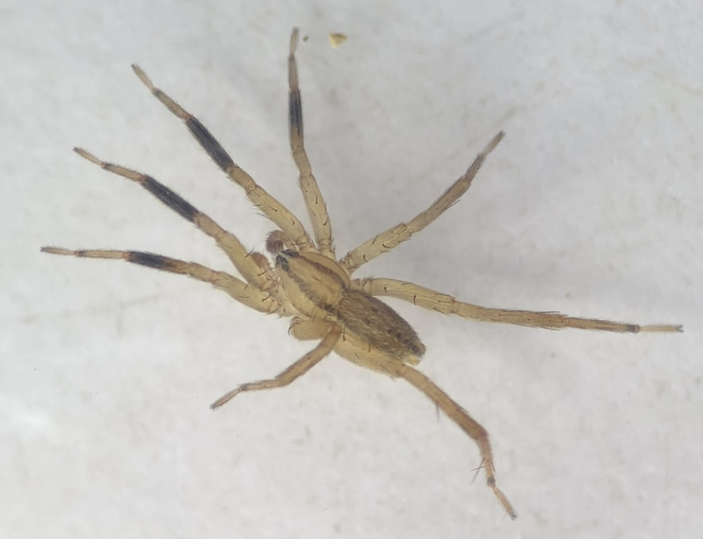
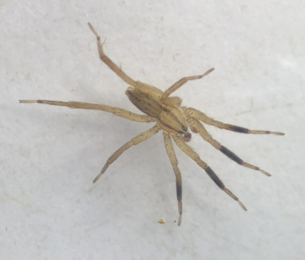
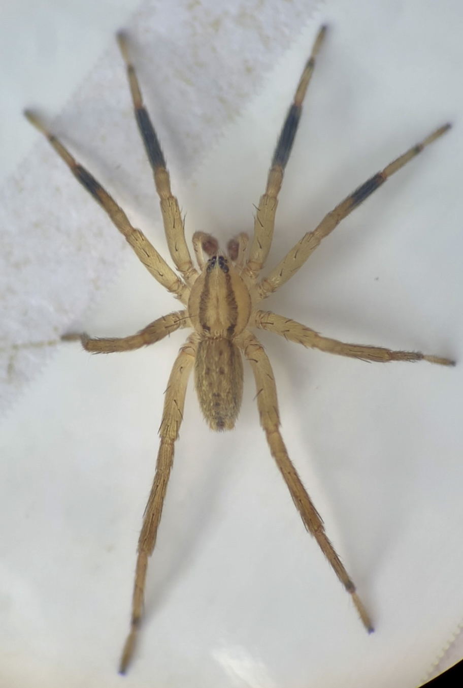
Photos and media
Spatial distribution - hectad map
Click on one of the date ranges in the key to highlight that particular range. Click anywhere else on the map to go back to all three date ranges.
Thresholds:
Move mouse cursor over dot for info
Rejected records are excluded from this map. Unverified records are included.
Temporal distribution - records by year
Records that span more than one year are not included in this chart.
Temporal distribution - records by week
__