Species Details
- Species name
- Agelena labyrinthica (Clerck, 1757)
- Common name
- Labyrinth Spider
- Taxonomy
- Animalia :: Araneae :: Agelenidae
- tall sward & scrub
Distribution
The species is widespread in much of southern England but more patchy in central England and coastal Wales. It is very scattered in northern England and not recorded from Scotland. It is widespread in western and central Europe as far north as southern Norway.Habitat and ecology
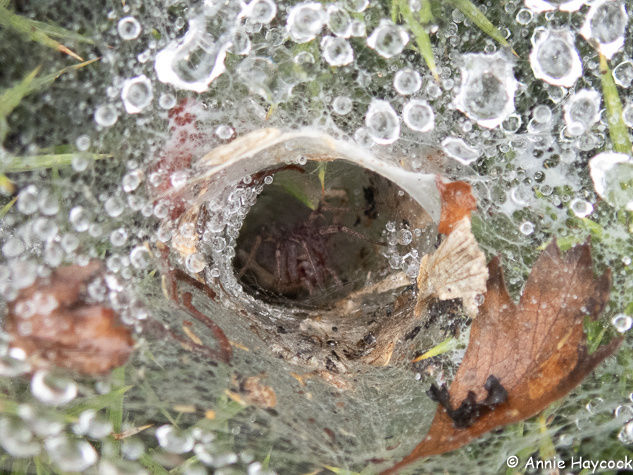
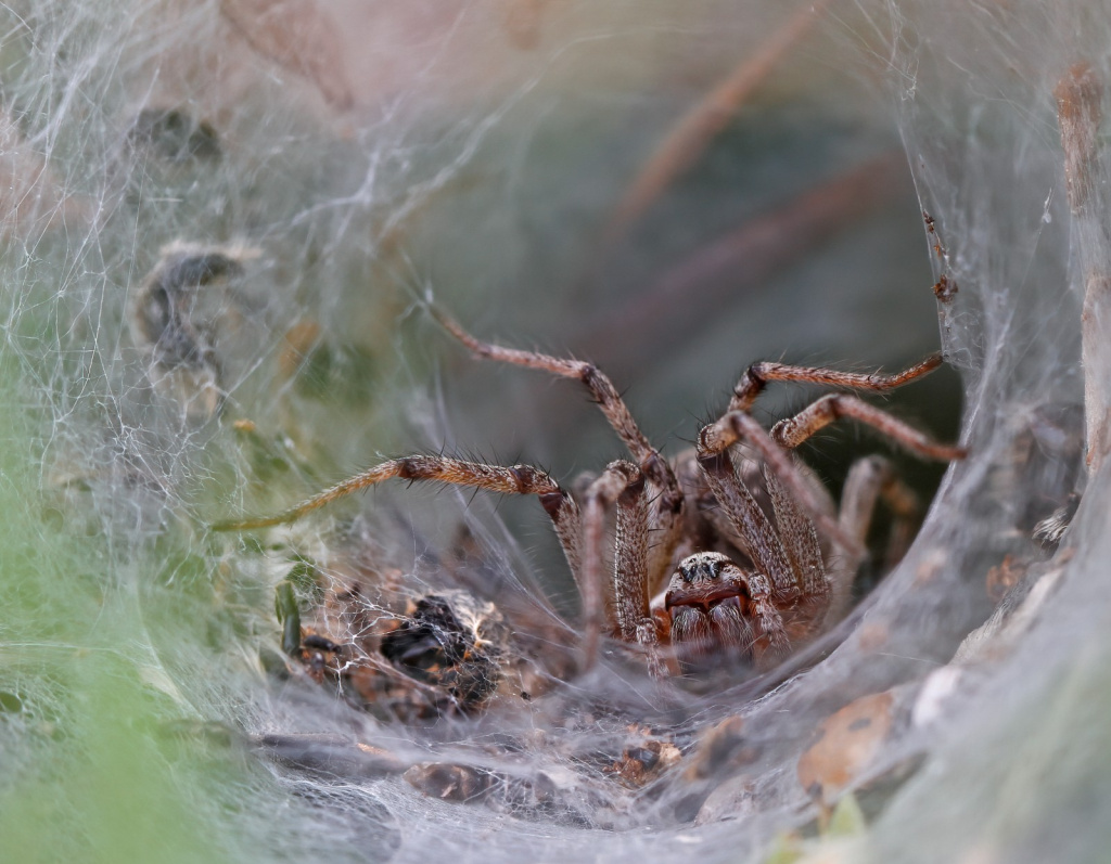
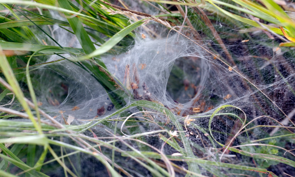
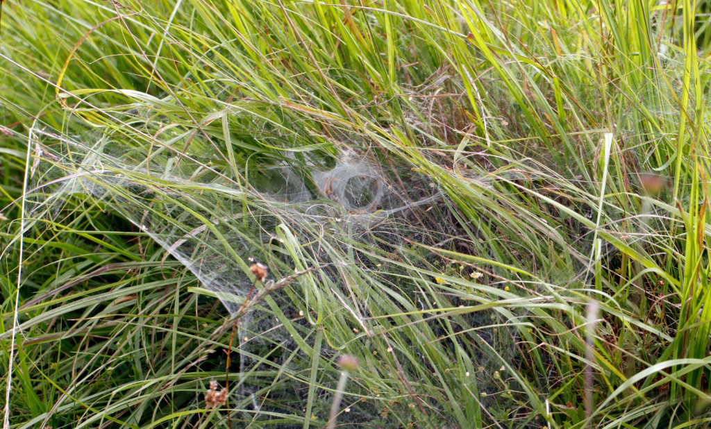
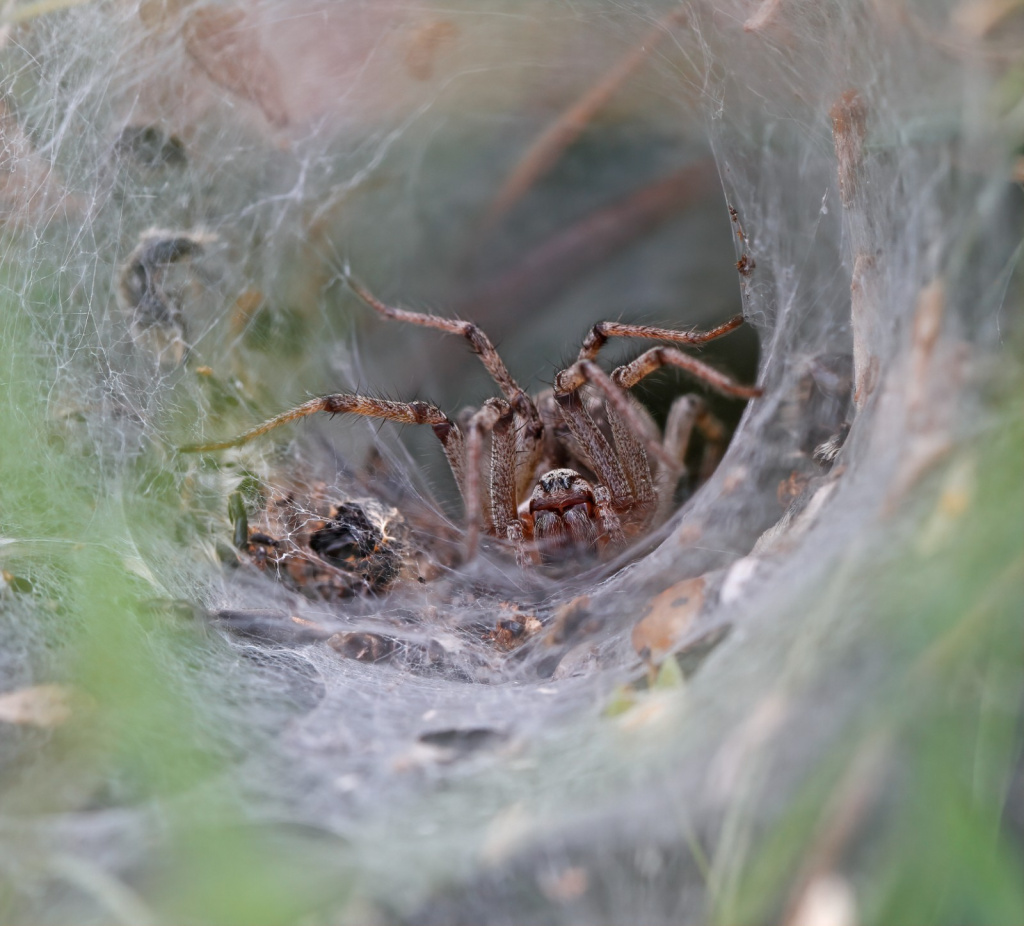
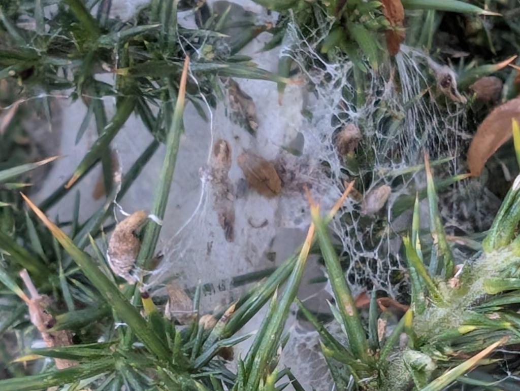
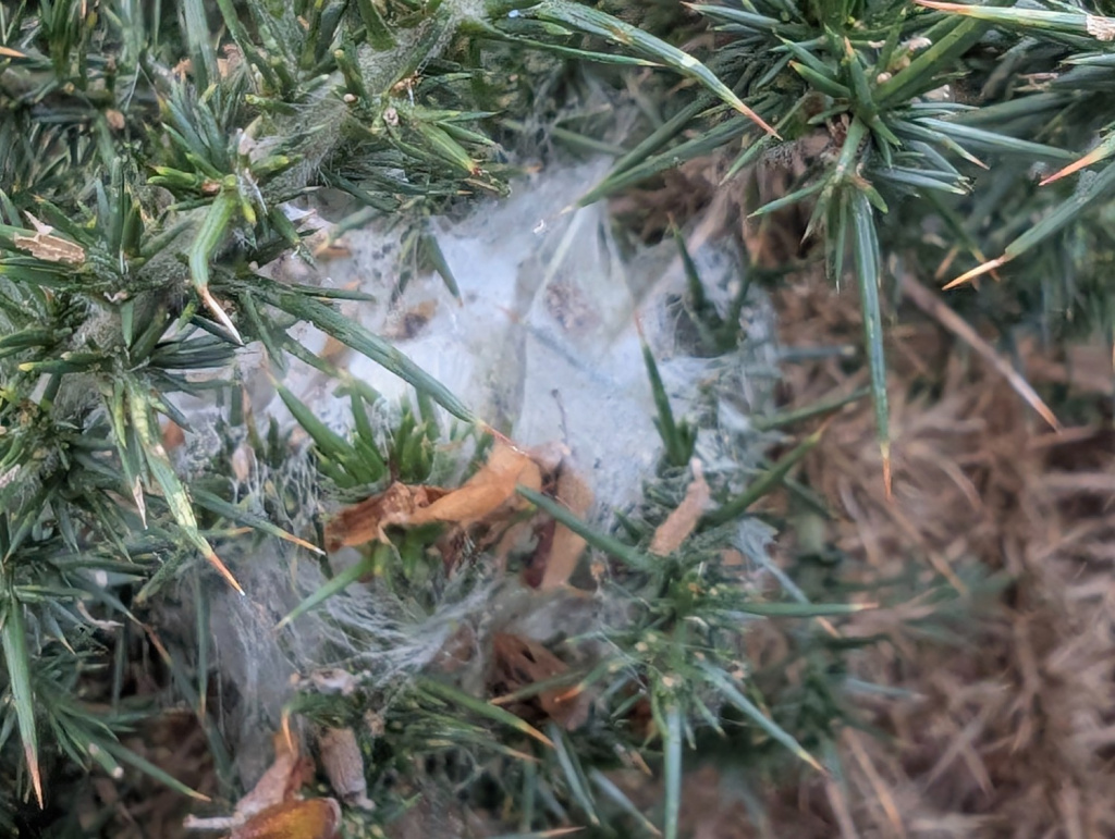
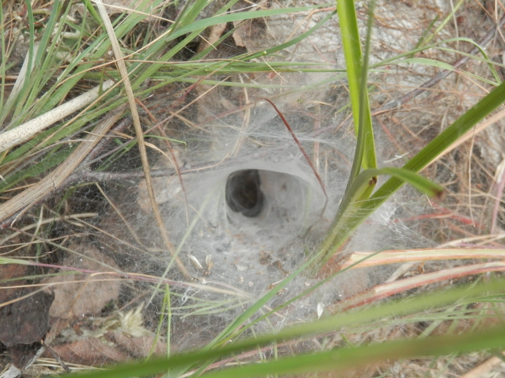
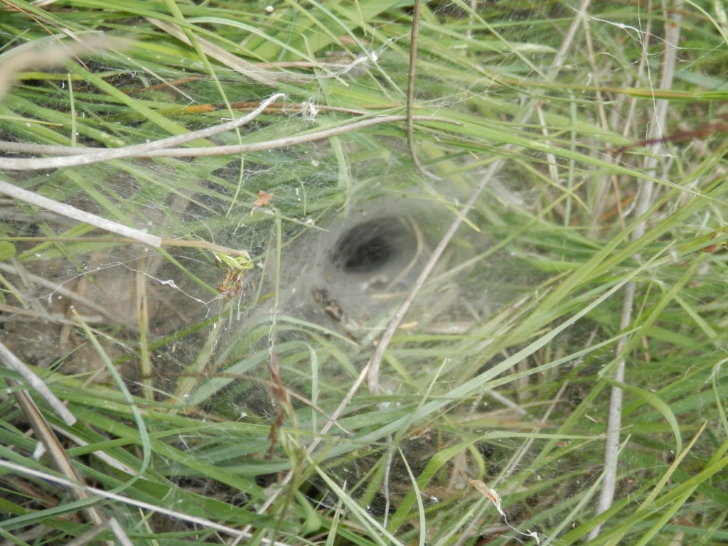
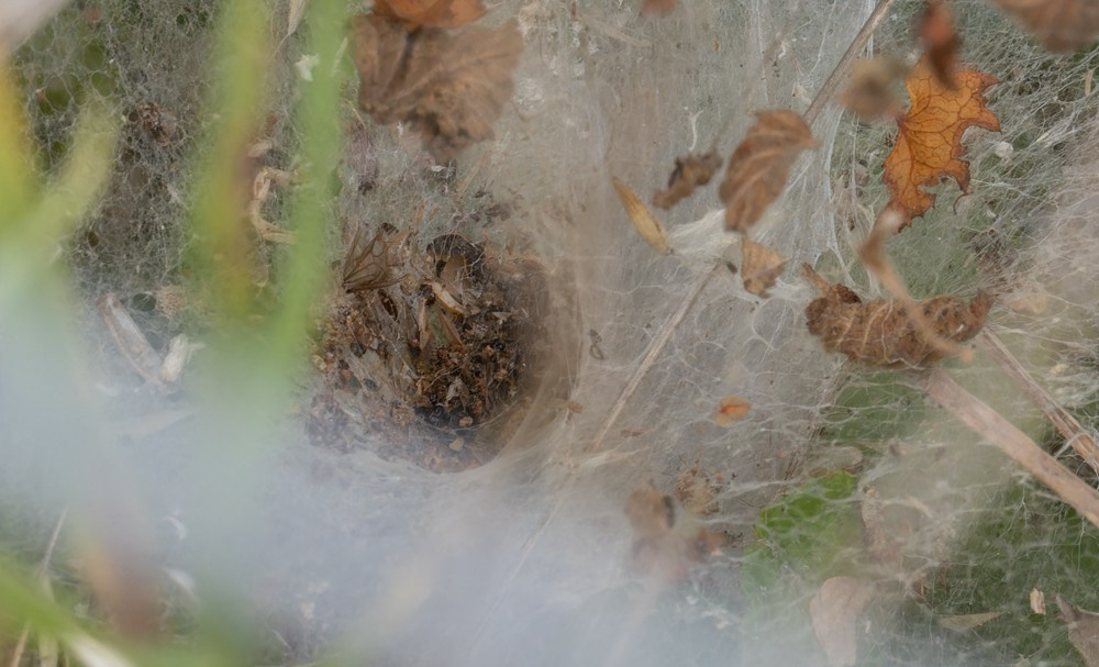
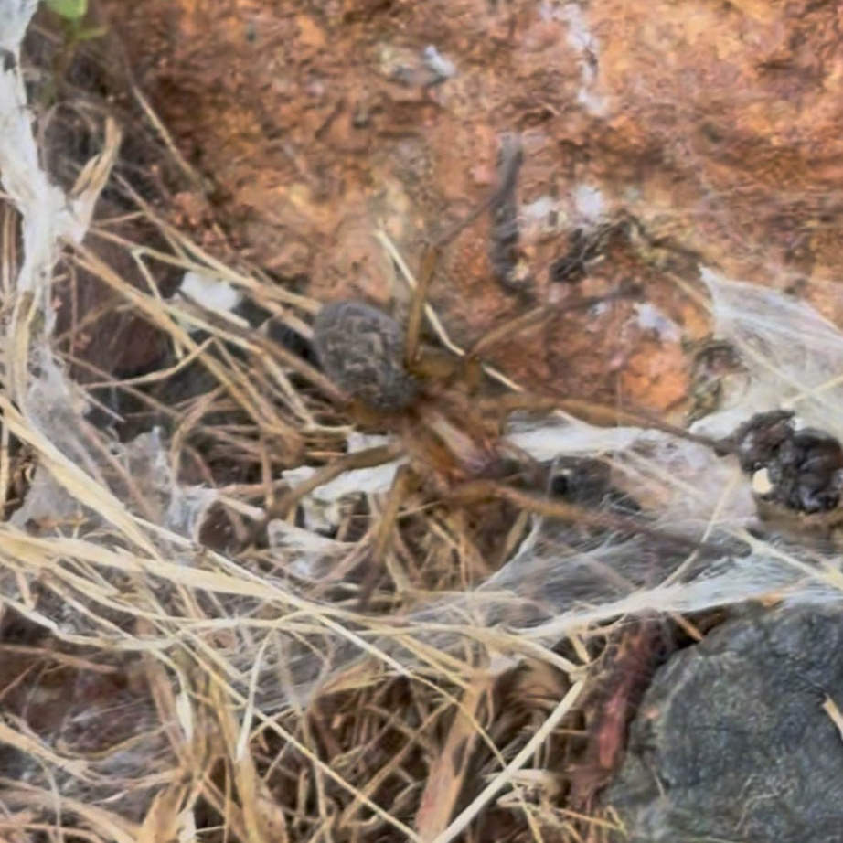
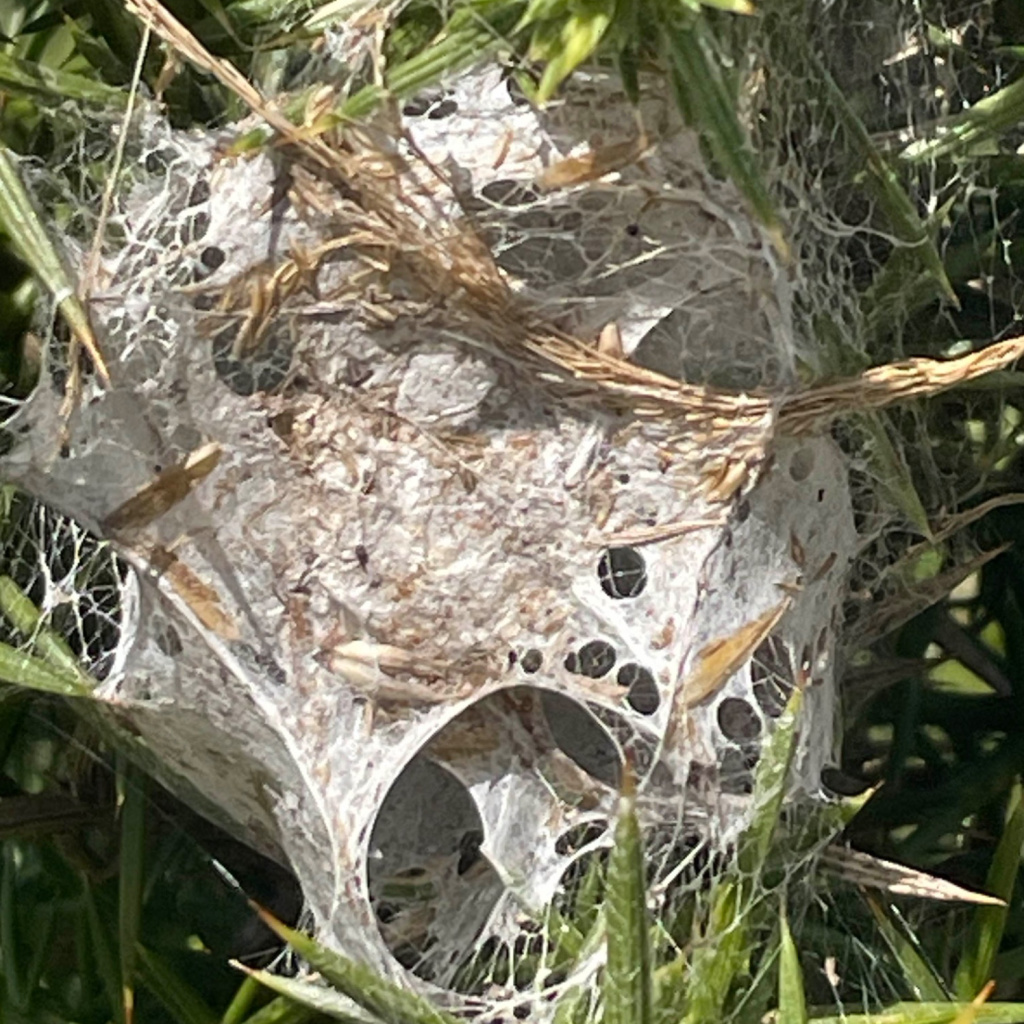
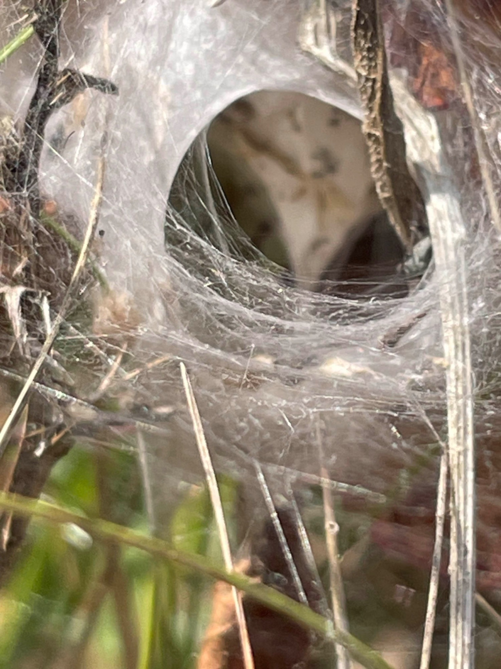
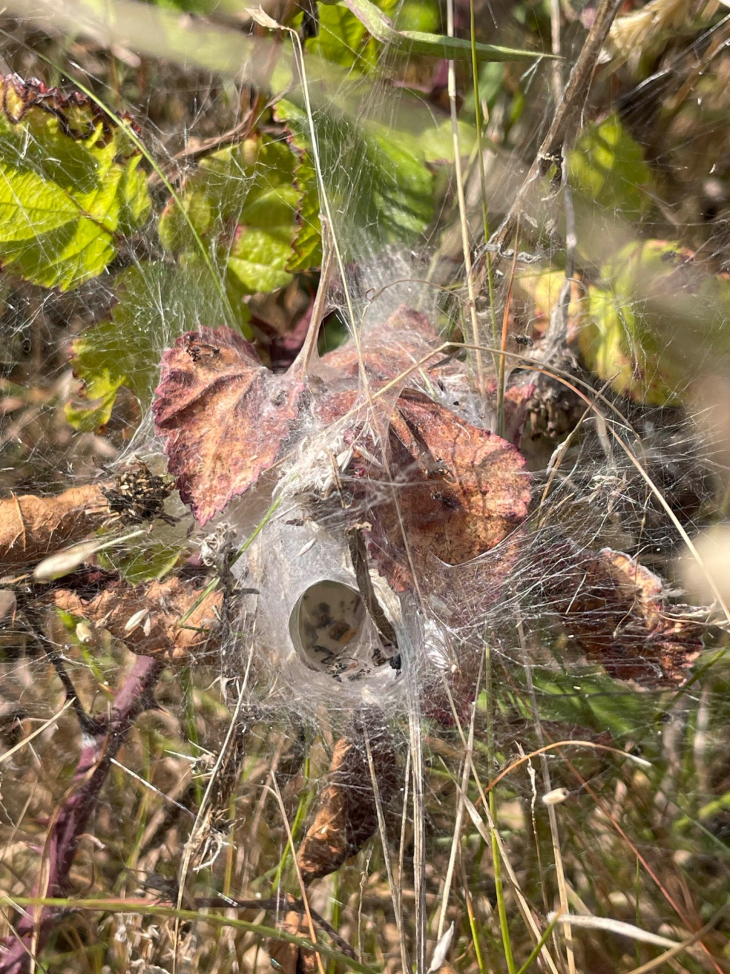
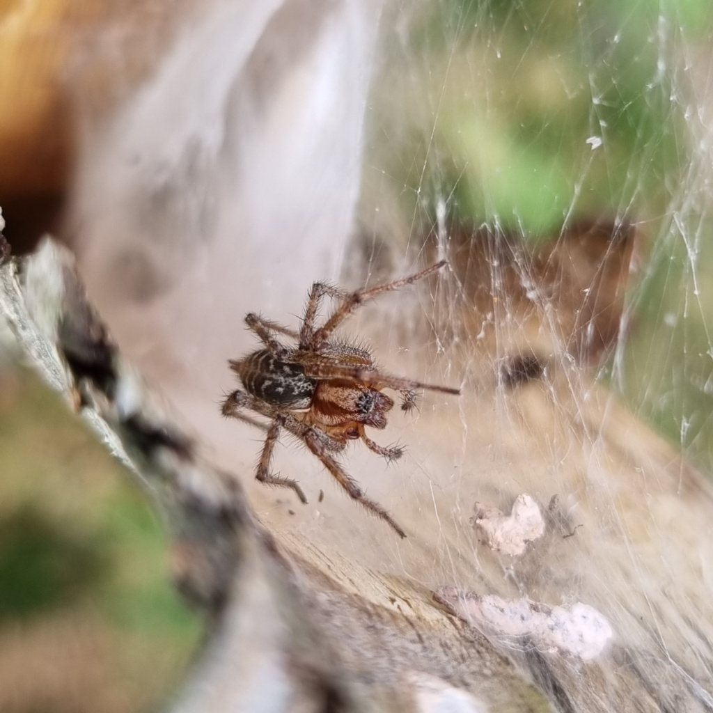
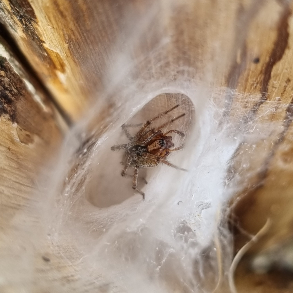
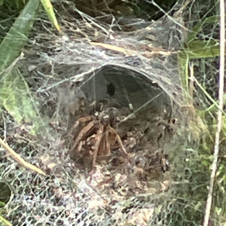
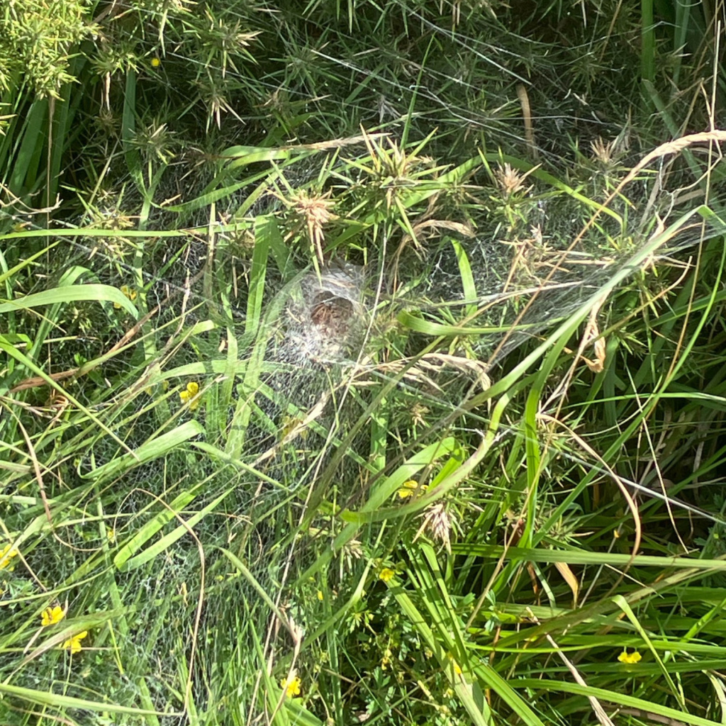
This species is found in the vegetation of rough uncut grassland, uncultivated field edges and low bushes of gorse and heather where it spins a large conspicuous sheet web with a funnel retreat on or above the ground. It can occur at high densities. Juveniles often make webs in lower vegetation e.g. short grass. The spider waits at the end of the tubular retreat for prey, largely grasshoppers, to alight and become entangled on the web whereupon it rushes out and takes the prey down the tube for consumption. In late summer, the female builds a large and very elaborate chamber in the vegetation to enclose her eggs. The labyrinth of passages within its dense white walls have earned the spider her name of labyrinthica (Bristowe 1958). Adults of both sexes are found mainly in July and August, females later. Males are often found cohabiting within the retreat of a penultimate instar female, as happens in at least some other agelenids, such as Tegenaria saeva and T. gigantea.Status
Common in the south of England. Author of profile: Doug Marriott and Geoff OxfordReferences
Bristowe, W. S. 1958. World of spiders. London: Collins New Naturalist.Stats
- First recorded
- 1820
- Last recorded
- 2026
- Total records
- 4,393
- Total visits
- 4,411
Conservation status
Agelena labyrinthica
| Source | Reporting category | Designation | Date designated | Comments |
|---|---|---|---|---|
| A Review of the scarce and threatened spiders (Araneae) of Great Britain: Species Status No. 22 (Sep 2017) | Red listing based on 2001 IUCN guidelines | Least concern | 01/09/2017 | Threats: None identified. |
Photos and media


Spatial distribution - hectad map
Click on one of the date ranges in the key to highlight that particular range. Click anywhere else on the map to go back to all three date ranges.
Thresholds:
Move mouse cursor over dot for info
Rejected records are excluded from this map. Unverified records are included.
Temporal distribution - records by year
Records that span more than one year are not included in this chart.
Temporal distribution - records by week
__