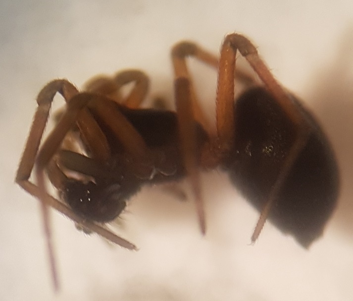
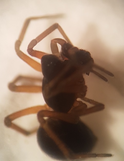
Species Details
- Species name
- Araeoncus crassiceps (Westring, 1861)
- Taxonomy
- Animalia :: Araneae :: Linyphiidae
- tall sward & scrub
Distribution
The species is widespread in Wales, northern England and north-western Scotland, though the majority of recent records are from Scotland. In the south and east there are very few recent records. It is a Palaearctic species, widespread in most of north-western and central Europe.Habitat and ecology
A. crassiceps occurs in a variety of habitats including moss, grass, straw, litter, tideline debris and heathland, but in rather damper conditions than those favoured by A. humilis. On heathland in Dorset males were found to be active from May to July.Status
This species seems to have undergone a significant major decline. Trend analysis of the continuing decline in area of occupancy over the period 1976 to 2005 indicates a reduction in population size of 45% over a ten year period.Threats
Destruction of heathland and grassland for building and agricultural development. Drainage of wet areas in these habitats.Management and conservation
Prevent further habitat loss in heathlands and grasslands due to urban and agricultural development. Maintain wet areas in heathlands and grasslands. Text based on Dawson, I.K., Harvey, P.R., Merrett, P. & Russell-Smith, A.R. (in prep.).Stats
- First recorded
- 1894
- Last recorded
- 2026
- Total records
- 954
- Total visits
- 932
Conservation status
Araeoncus crassiceps
| Source | Reporting category | Designation | Date designated | Comments |
|---|---|---|---|---|
| A Review of the scarce and threatened spiders (Araneae) of Great Britain: Species Status No. 22 (Sep 2017) | Rare and scarce species | Nationally Scarce. Includes Red Listed taxa | 01/09/2017 | |
| A Review of the scarce and threatened spiders (Araneae) of Great Britain: Species Status No. 22 (Sep 2017) | Red listing based on 2001 IUCN guidelines | Least concern | 01/09/2017 | Lack of recording since 1993 in the Welsh peatlands, where it was formerly extensively recorded, is thought to be giving a false indication of decline. Threats: Destruction of heathland and grassland for building and agricultural development. Drainage of wet areas in these habitats. |
Photos and media
Spatial distribution - hectad map
Click on one of the date ranges in the key to highlight that particular range. Click anywhere else on the map to go back to all three date ranges.
Thresholds:
Move mouse cursor over dot for info
Rejected records are excluded from this map. Unverified records are included.
Temporal distribution - records by year
Records that span more than one year are not included in this chart.
Temporal distribution - records by week
__