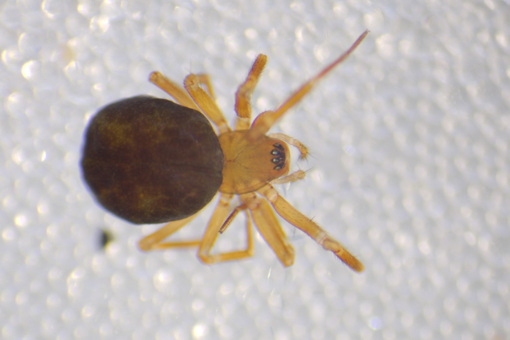
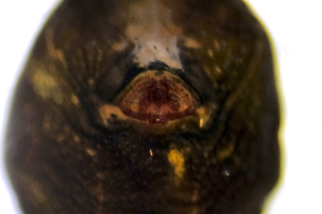
Species Details
- Species name
- Centromerus incilium (L. Koch, 1881)
- Synonym
- Centromerus similis sensu Bristowe, 1939 non Kulczynski
- Taxonomy
- Animalia :: Araneae :: Linyphiidae
- tall sward & scrub
Distribution
Apart from old (doubtful?) records from Aberdeenshire, the species is confined to south-central and south-eastern England. It is widespread but uncommon in north-western and central Europe. It has not been recorded from Ireland.Habitat and ecology
C. incilium occurs mainly on chalk grassland and on sandy grassland in Essex and Breckland, in both long and short grass, occasionally on arable land. It has occurred on roadside verges and in old chalk and sand pits especially on sparsely vegetated ground and lichen heath. Both sexes are adult from autumn to late spring with a peak in winter, females also until June.Status
Although recorded from 16 hectads since 1992, only twelve of these are where spiders were recorded both before and after this date. It shows a moderate decline, hence the Watching Brief.Threats
The loss of grassland to agriculture or forestry.Management and conservation
Maintain grassland by traditional grazing or periodic scraping to return to early succession. Text based on Dawson, I.K., Harvey, P.R., Merrett, P. & Russell-Smith, A.R. (in prep.).Stats
- First recorded
- 1900
- Last recorded
- 2025
- Total records
- 358
- Total visits
- 350
Conservation status
Centromerus incilium
| Source | Reporting category | Designation | Date designated | Comments |
|---|---|---|---|---|
| A Review of the scarce and threatened spiders (Araneae) of Great Britain: Species Status No. 22 (Sep 2017) | Rare and scarce species | Nationally Scarce. Includes Red Listed taxa | 01/09/2017 | |
| A Review of the scarce and threatened spiders (Araneae) of Great Britain: Species Status No. 22 (Sep 2017) | Red listing based on 2001 IUCN guidelines | Least concern | 01/09/2017 | Threats: The loss of grassland to agriculture or forestry. |
Photos and media
Spatial distribution - hectad map
Click on one of the date ranges in the key to highlight that particular range. Click anywhere else on the map to go back to all three date ranges.
Thresholds:
Move mouse cursor over dot for info
Rejected records are excluded from this map. Unverified records are included.
Temporal distribution - records by year
Records that span more than one year are not included in this chart.
Temporal distribution - records by week
__