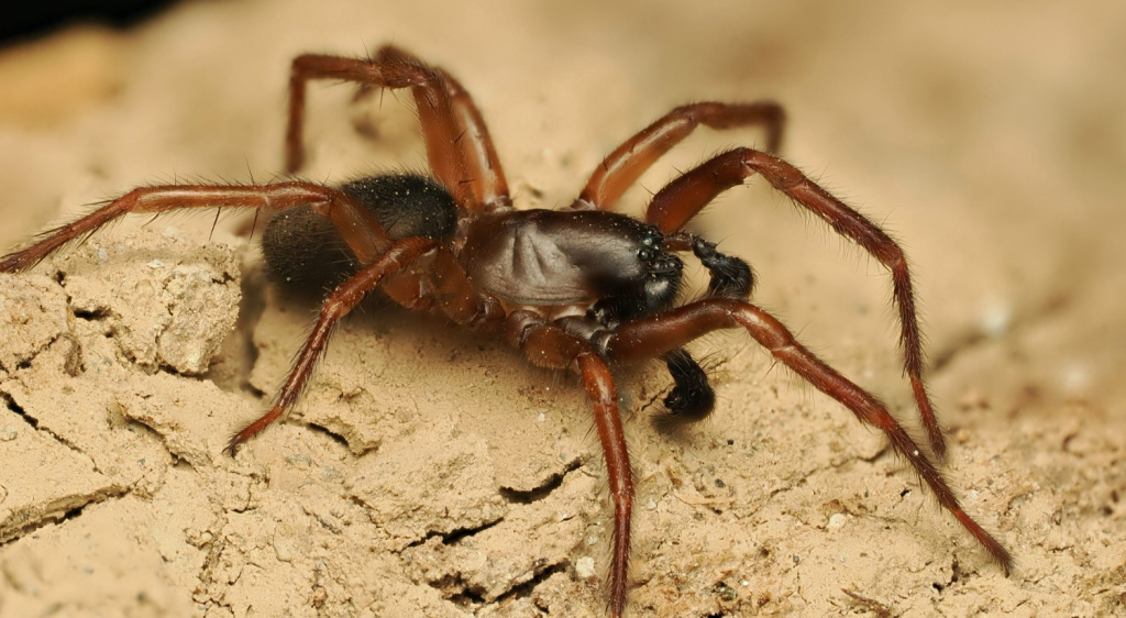
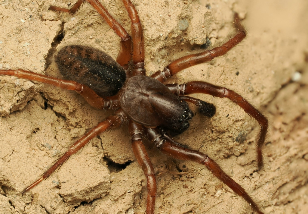
Species Details
- Species name
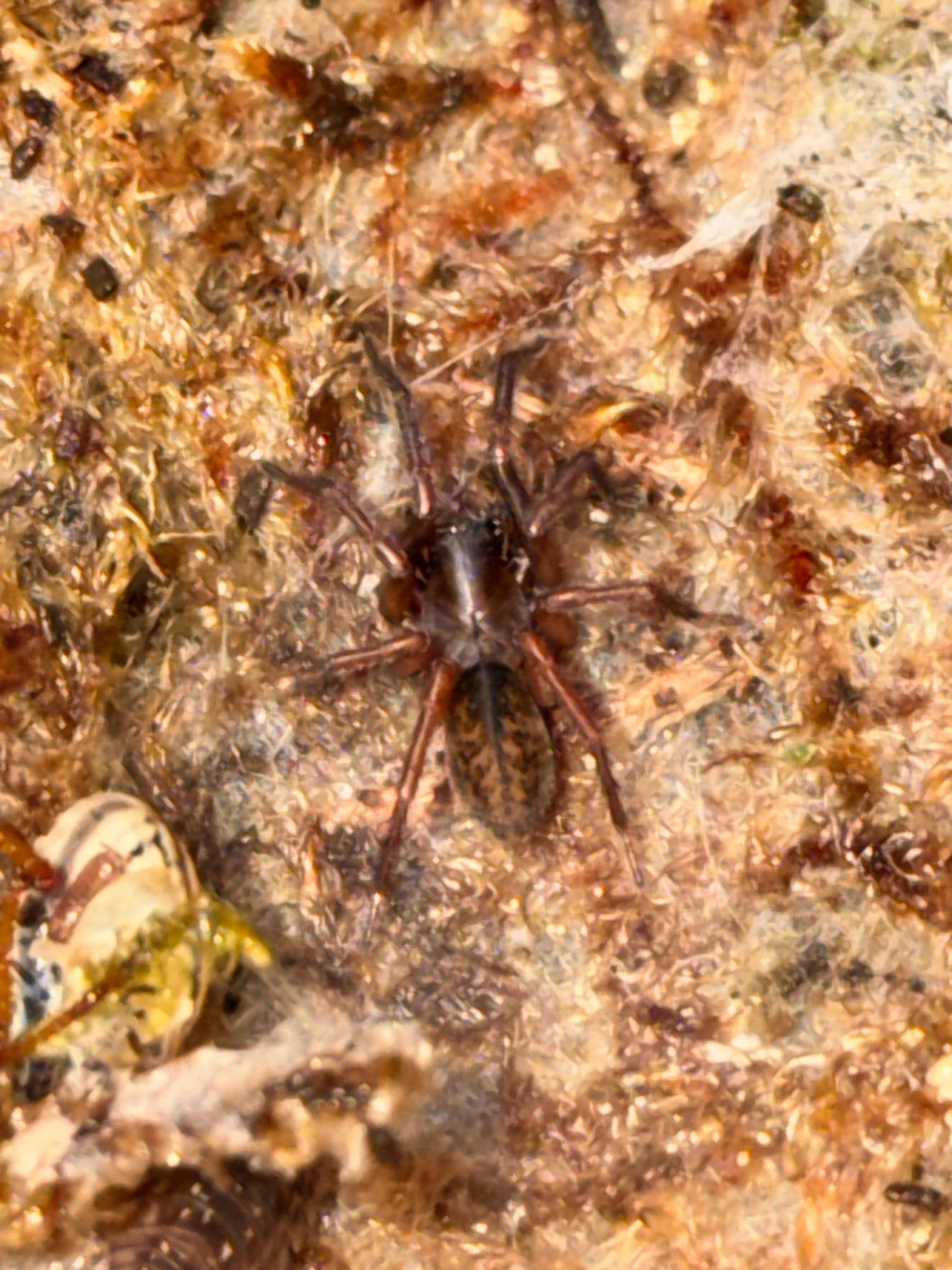
- Coelotes atropos (Walckenaer, 1830)
- Synonyms
- Coelotes saxatilis Blackwall, Amaurobius atropos (Walckenaer, 1830)
- Taxonomy
- Animalia :: Araneae :: Amaurobiidae
Distribution
The species is widespread across Wales and north-west England, and in upland areas of south-western England. It is absent throughout much of south-eastern England and Scotland. C. atropos has been recorded from France, Belgium, Denmark, Sweden (where it is included on their Red List (Gärdenfors 2000)), Germany, Switzerland, the Czech Republic, Poland, Hungary and Romania. It has not been recorded beyond Europe (Platnick 1998).Habitat and ecology
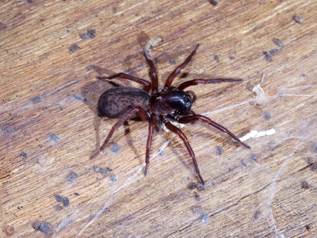
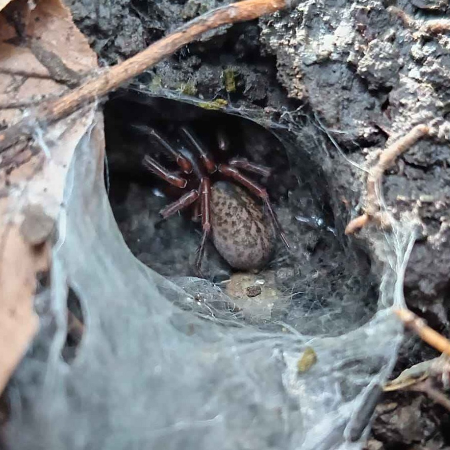
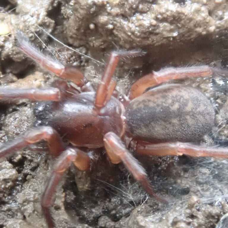
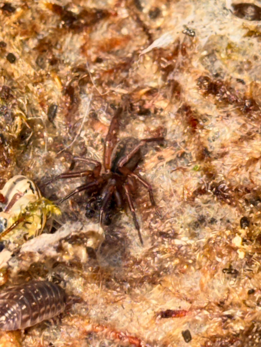
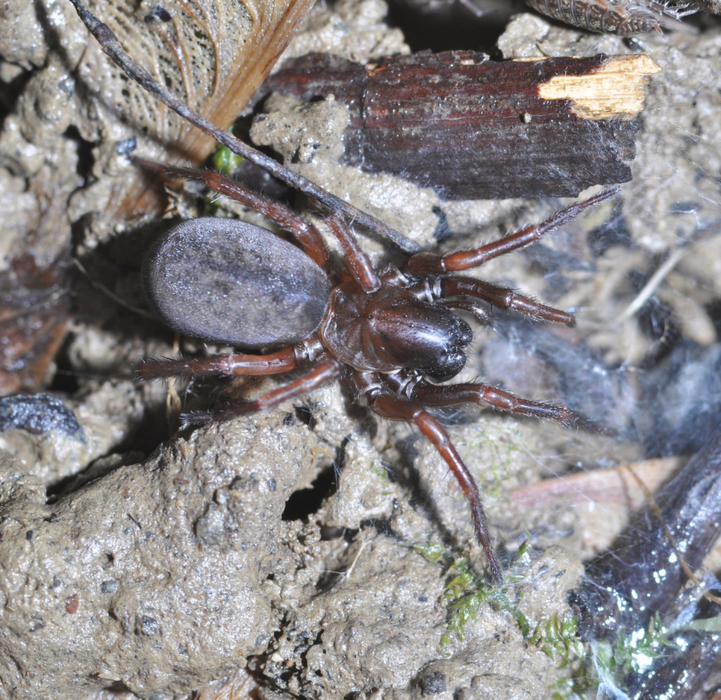
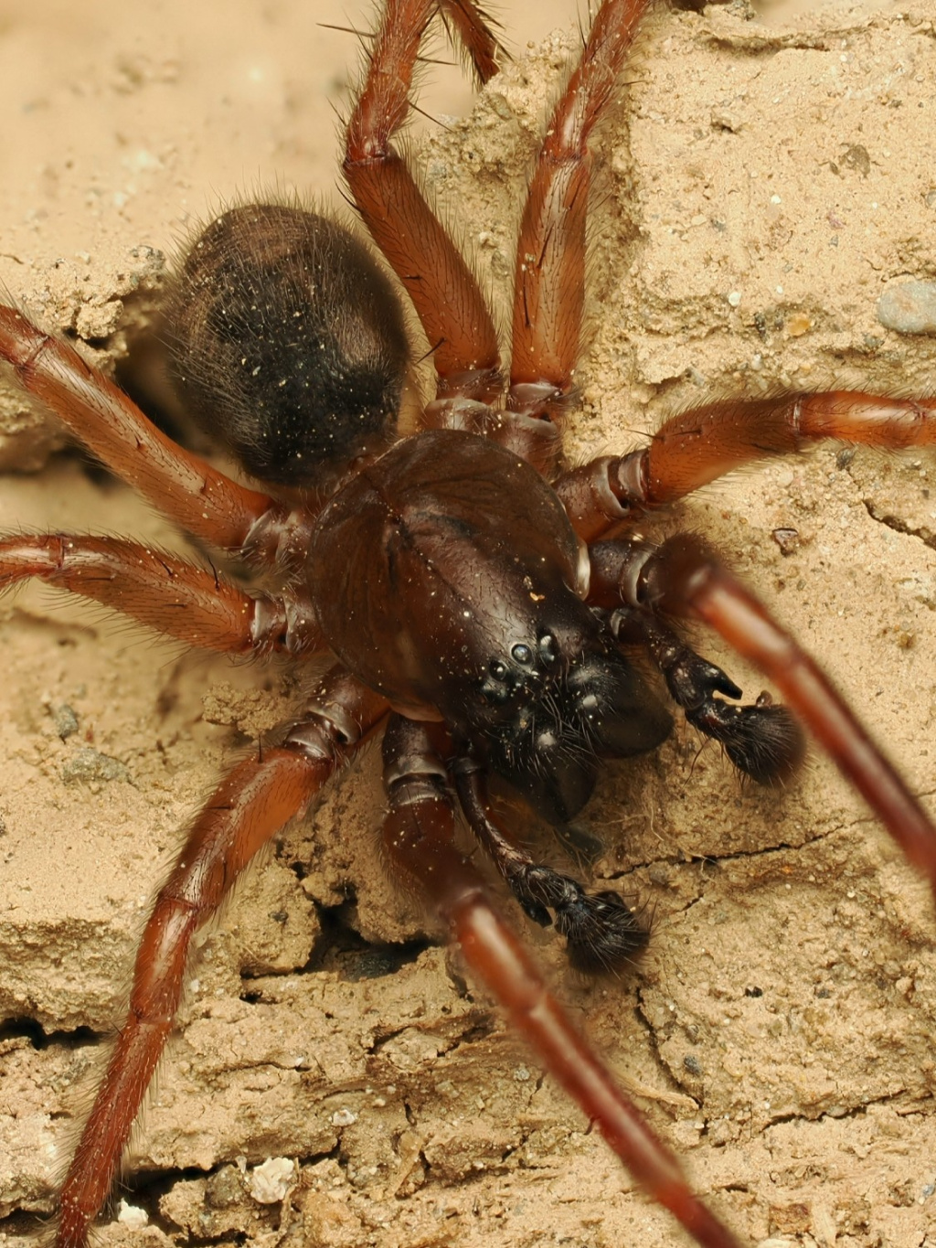
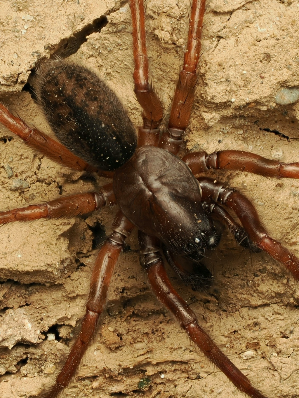
C. atropos constructs a silk-lined burrow beneath rocks and logs in woodland (broad-leaved and coniferous), moorland, heathland and mountains. In woodland sites C. atropos can also be found living arboreally in rot-holes (M. Askins, pers. comm.). Adults of both sexes have been recorded throughout the year, but males mainly in the autumn and winter, females in spring and early summer. Males are often found guarding females in their retreats. Single egg-sacs are produced between May and September and are affixed to a rock or log within the female's retreat. The resultant spiderlings may remain with their mother for the first few instars prior to dispersal.Status
The spider is common in the west, becoming scarcer towards Scotland. It is very rare in south-eastern England. Original author of profile: R.C. Gallon Text based on Harvey, P.R., Nellist, D.R. & Telfer, M.G. (eds) 2002. Provisional atlas of British spiders (Arachnida, Araneae), Volumes 1 & 2. Huntingdon: Biological Records Centre.Stats
- First recorded
- 1826
- Last recorded
- 2025
- Total records
- 3,542
- Total visits
- 3,407
Conservation status
Coelotes atropos
| Source | Reporting category | Designation | Date designated | Comments |
|---|---|---|---|---|
| A Review of the scarce and threatened spiders (Araneae) of Great Britain: Species Status No. 22 (Sep 2017) | Red listing based on 2001 IUCN guidelines | Least concern | 01/09/2017 |
Photos and media


Spatial distribution - hectad map
Click on one of the date ranges in the key to highlight that particular range. Click anywhere else on the map to go back to all three date ranges.
Thresholds:
Move mouse cursor over dot for info
Rejected records are excluded from this map. Unverified records are included.
Temporal distribution - records by year
Records that span more than one year are not included in this chart.
Temporal distribution - records by week
__