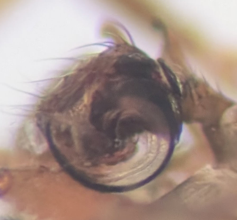
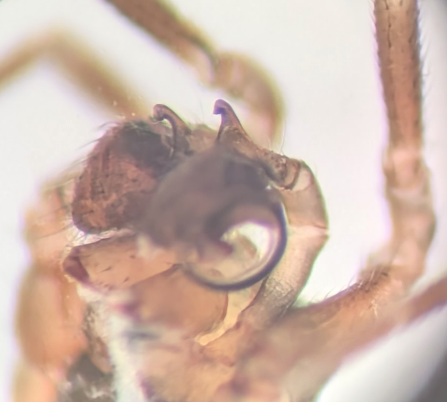
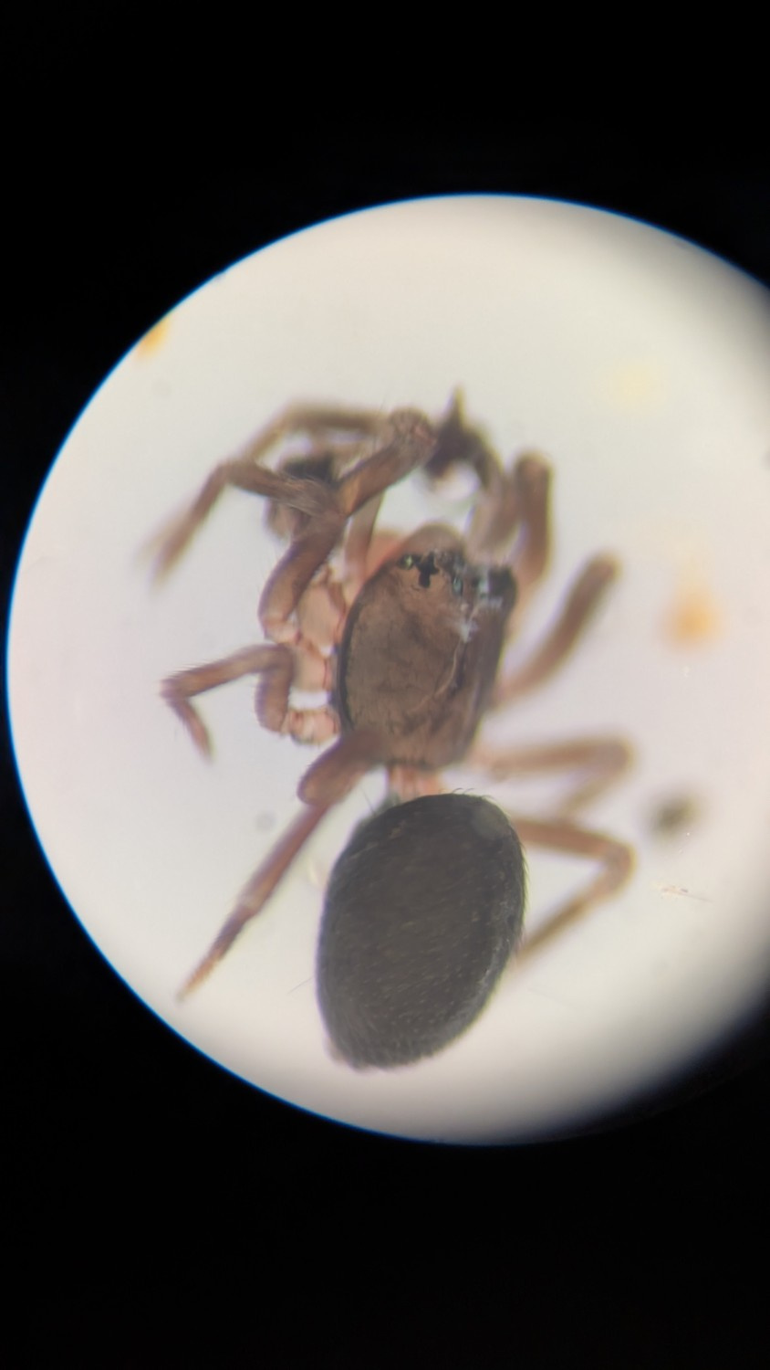
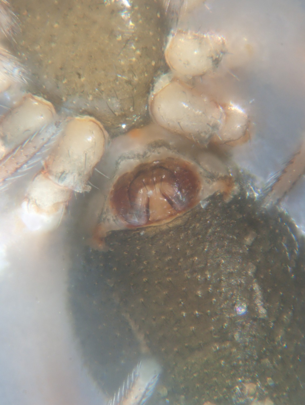
Species Details
- Species name
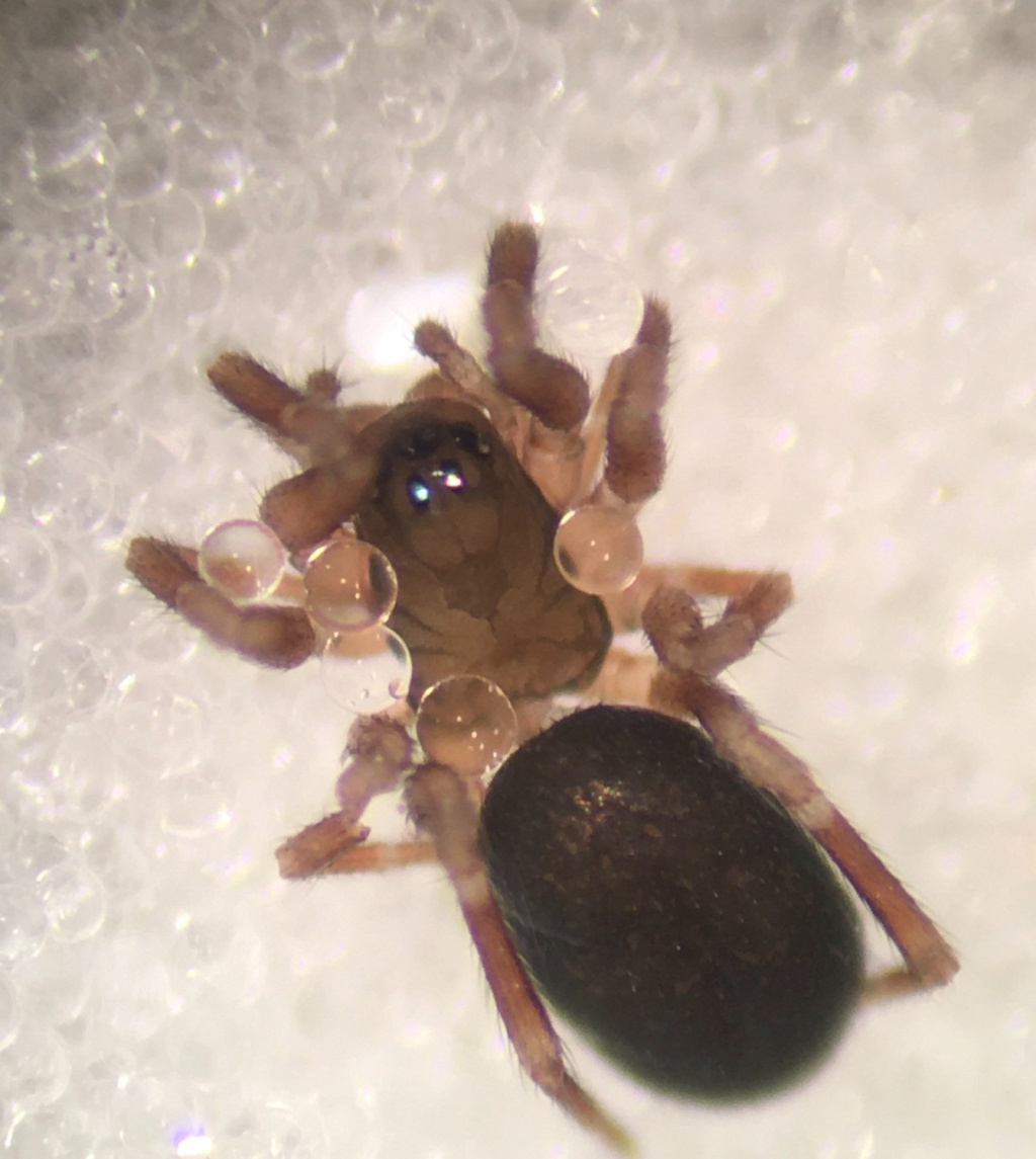
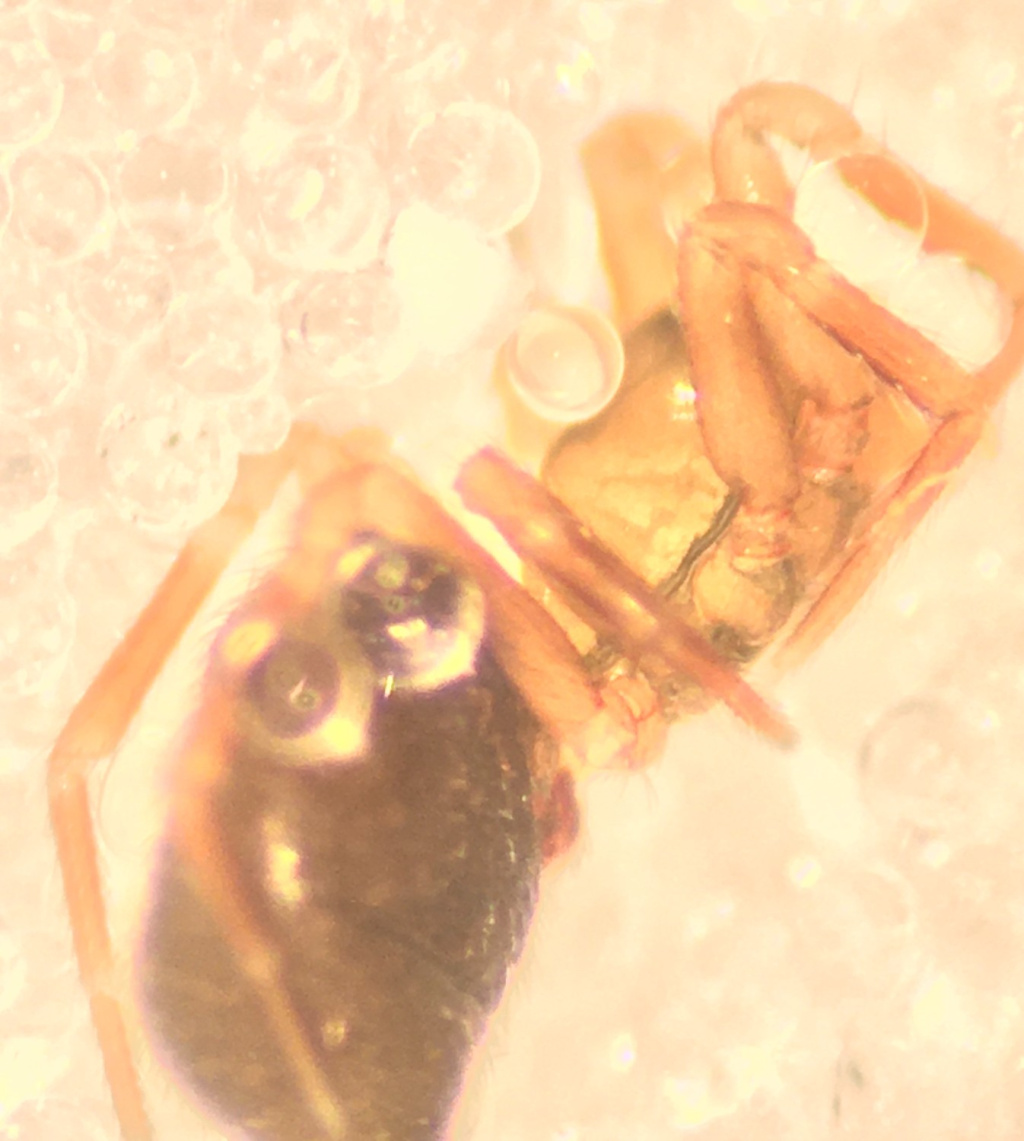
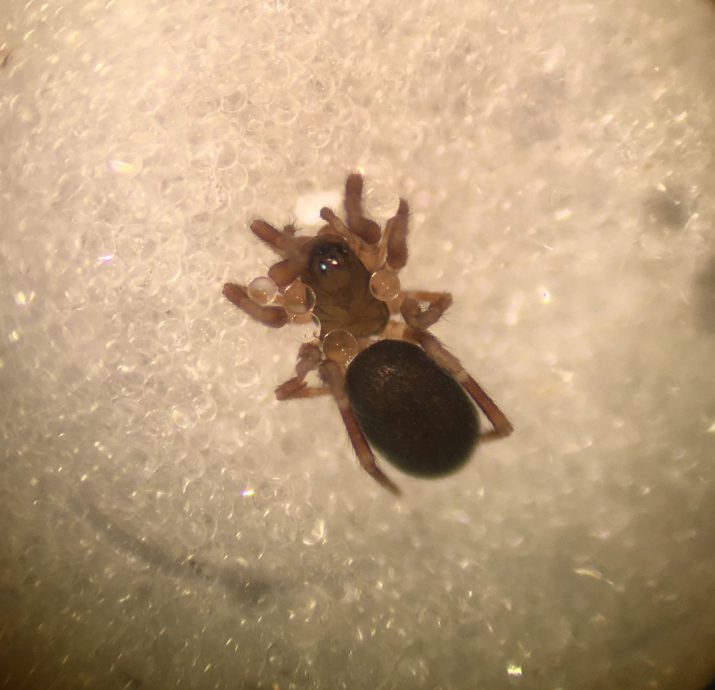
- Panamomops sulcifrons (Wider, 1834)
- Synonym
- Panamomops bicuspis (O.P.-Cambridge)
- Taxonomy
- Animalia :: Araneae :: Linyphiidae
- tall sward & scrub
Distribution
Widespread in central and southern England but absent in the south-west and very scattered in the north and parts of the east and south. Absent from Ireland and Scandinavia, but otherwise widespread in north-western and central Europe.Habitat and ecology
Roberts (1985) suggests that P. sulcifrons has a preference for calcareous grassland, and Crocker & Daws (1996) add flood meadows, drier hay meadows and quarries. In Essex the species has been found in woodland edge habitat, flood and tidal debris, landslip, unimproved meadows, Thames Terrace grasslands and grazing marsh grassland. It has also been found in calcareous arable land (M. Shardlow, pers. comm.). Adults may occasionally be found in any month of the year, but there is a large peak of records in late spring and early summer.Status
Local and usually infrequent.Threats
Threats are likely to include loss of open habitats to seral succession and agricultural improvement of grasslands.Management and conservation
Rotational management or low level grazing is probably necessary at many sites to maintain structural diversity and prevent seral succession. Text based on Dawson, I.K., Harvey, P.R., Merrett, P. & Russell-Smith, A.R. (in prep.).Stats
- First recorded
- 1900
- Last recorded
- 2026
- Total records
- 683
- Total visits
- 668
Conservation status
Panamomops sulcifrons
| Source | Reporting category | Designation | Date designated | Comments |
|---|---|---|---|---|
| A Review of the scarce and threatened spiders (Araneae) of Great Britain: Species Status No. 22 (Sep 2017) | Rare and scarce species | Nationally Scarce. Includes Red Listed taxa | 42979 | |
| A Review of the scarce and threatened spiders (Araneae) of Great Britain: Species Status No. 22 (Sep 2017) | Red listing based on 2001 IUCN guidelines | Least concern | 42979 | Threats: Threats are likely to include loss of open habitats to seral succession and agricultural improvement of grasslands. |
Photos and media
Spatial distribution - hectad map
Click on one of the date ranges in the key to highlight that particular range. Click anywhere else on the map to go back to all three date ranges.
Thresholds:
Move mouse cursor over dot for info
Rejected records are excluded from this map. Unverified records are included.
Temporal distribution - records by year
Records that span more than one year are not included in this chart.
Temporal distribution - records by week
__