Species Details
- Species name
- Singa hamata (Clerck, 1757)
- Synonyms
- Singa hamatus (Walckenaer, 1802), Singa tubulosa
- Taxonomy
- Animalia :: Araneae :: Araneidae
- acid & sedge peats
Distribution
The species is widely scattered as far north as central Scotland. Its distribution on the Continent is poorly known.Habitat and ecology
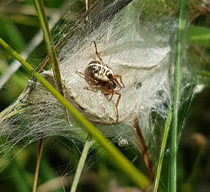
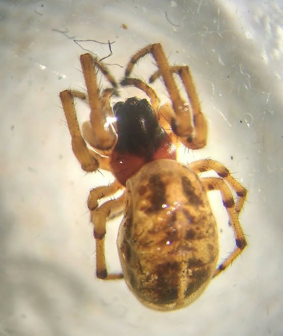
Singa hamata spins its web on low vegetation usually in damp habitats, for example damp pasture and raised bogs but also in areas of rough unmanaged grassland. A pinkish retreat containing the egg-sac can often be found on vegetation near the web. Both sexes mature in May and June, the females lasting through to October.Status
The spider may be abundant in some localities but is very local.Threats
The loss of raised bogs and damp pasture, particularly through drainage, and the regular cutting of grassland poses a significant threat to this species.Management and conservation
Where damp pasture is still present grassland cutting should be on a rotational basis so that areas of long grass and herbage within the pasture are left each year to provide a permanent habitat for S. hamata. Of particular importance are well established tussocks of long grass and where possible these should remain. Text based on Dawson, I.K., Harvey, P.R., Merrett, P. & Russell-Smith, A.R. (in prep.).Stats
- First recorded
- 1897
- Last recorded
- 2025
- Total records
- 217
- Total visits
- 213
Conservation status
Singa hamata
| Source | Reporting category | Designation | Date designated | Comments |
|---|---|---|---|---|
| A Review of the scarce and threatened spiders (Araneae) of Great Britain: Species Status No. 22 (Sep 2017) | Rare and scarce species | Nationally Scarce. Includes Red Listed taxa | 42979 | |
| A Review of the scarce and threatened spiders (Araneae) of Great Britain: Species Status No. 22 (Sep 2017) | Red listing based on 2001 IUCN guidelines | Least concern | 42979 | Threats: The loss of raised bogs and damp pasture, particularly through drainage, and the regular cutting of grassland poses a significant threat to this species. |
Photos and media
Spatial distribution - hectad map
Click on one of the date ranges in the key to highlight that particular range. Click anywhere else on the map to go back to all three date ranges.
Thresholds:
Move mouse cursor over dot for info
Rejected records are excluded from this map. Unverified records are included.
Temporal distribution - records by year
Records that span more than one year are not included in this chart.
Temporal distribution - records by week
__