Species Details
- Species name
- Thomisus onustus Walckenaer, 1806
- Synonyms
- Thomisus abbreviatus, Thomisus albus
- Taxonomy
- Animalia :: Araneae :: Thomisidae
- tall sward & scrub
Distribution
The species is restricted to central southern and south-east England. It is widespread in Europe, especially in the south.Habitat and ecology
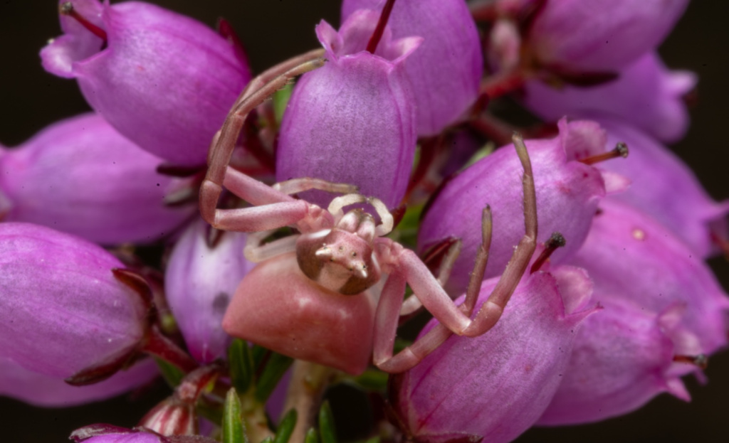
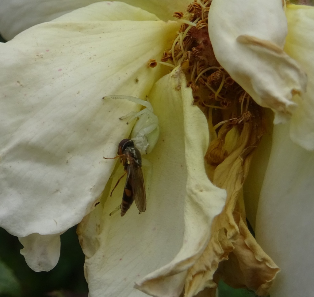
T. onustus occurs in dry or moderately wet, mainly mature, heathland, usually on flowers of Erica tetralix or E. cinerea, where it sits to ambush prey, mostly bees and large flies. Adult females can adjust their background colour to some extent in order to match that of the flower upon which they sit (Oxford & Gillespie 1998). Both sexes are adult in May and June, and females deposit their egg-sac in July spun up in flower heads of Erica.Status
The spider is widespread in central southern England, and often abundant where found, but very local. It may have undergone a moderate decline in occupied 10 km squares post-1992.Threats
The loss of heathland to agriculture, forestry, development and excessive burning.Management and conservation
This species occurs mainly on mature heather, which should be maintained by rotational management to maintain the full range of seral stages of heather. Large fires are likely to be detrimental, although the young stages disperse readily and can start to colonise new areas about 5 years after fire. Text based on Dawson, I.K., Harvey, P.R., Merrett, P. & Russell-Smith, A.R. (in prep.).Stats
- First recorded
- 1880
- Last recorded
- 2025
- Total records
- 254
- Total visits
- 253
Conservation status
Thomisus onustus
| Source | Reporting category | Designation | Date designated | Comments |
|---|---|---|---|---|
| A Review of the scarce and threatened spiders (Araneae) of Great Britain: Species Status No. 22 (Sep 2017) | Rare and scarce species | Nationally Scarce. Includes Red Listed taxa | 42979 | |
| A Review of the scarce and threatened spiders (Araneae) of Great Britain: Species Status No. 22 (Sep 2017) | Red listing based on 2001 IUCN guidelines | Least concern | 42979 | Threats: The loss of heathland to agriculture, forestry, development and excessive burning. |
Photos and media


Spatial distribution - hectad map
Click on one of the date ranges in the key to highlight that particular range. Click anywhere else on the map to go back to all three date ranges.
Thresholds:
Move mouse cursor over dot for info
Rejected records are excluded from this map. Unverified records are included.
Temporal distribution - records by year
Records that span more than one year are not included in this chart.
Temporal distribution - records by week
__